Interactive case file · Spain and Portugal
Mapping Olive-Grove Structure
Move from connected olive landscapes to exact EuroCrops field boundaries, a balanced sample and canopy-height evidence.
01 · Landscape context
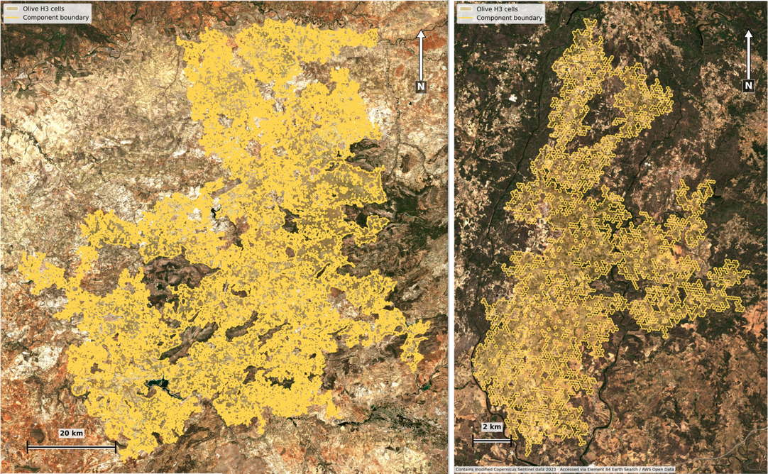
Two components, very different extents
EuroCrops V2 currently covers 16 EU Member States rather than the entire EU. H3 identifies connected olive concentrations; original parcel boundaries return in the field-level analysis.
Spain · Andalucía
Jaén, Córdoba, Granada and Málaga
- Fields
- 434,472
- H3 cells
- 168,902
- Summed field area
- 283,805.75 ha
Portugal · Norte
Terras de Trás-os-Montes
- Fields
- 11,111
- H3 cells
- 5,346
- Summed field area
- 4,818.00 ha
Two very small boundary fields fall in Alto Tâmega e Barroso.
02 · Image evidence
Move through every publication output
Use the tabs to compare landscape context, sampling design, matched fields and the final CHMv2 summaries. Click the image to enlarge it.
Interpretation boundary
The sample contains no measured harvest or production records, so it cannot explain the national production-per-hectare difference. Crown candidates are model detections rather than confirmed olive trees, and the findings represent these two connected landscapes rather than all olive fields in Spain and Portugal.
Attribution and methods
Attribution
- EuroCrops V2: European Commission Joint Research Centre and contributing national administrations.
- Sentinel-2 context: contains modified Copernicus Sentinel data 2023; catalogue access used Element 84 Earth Search.
- Copernicus DEM GLO-30: elevation, relief and slope variables.
- CHMv2: Meta and World Resources Institute, 2026, CC BY 4.0. Source imagery © Vantor.
Methods
- H3 resolution 10 identifies connected olive landscapes; the interactive envelopes are simplified for browser navigation.
- The statistical analysis uses original EuroCrops polygons of at least 1.5 ha.
- Samples are balanced on area, elevation, within-field relief, P90 slope and compactness.
- Candidate density and distance apply only to fields passing their respective CHMv2 screening steps.